


This year Earthware have been working alongside the TfL Online Team and BAE Systems Detica to create the new Transport for London Journey Planner. As of tomorrow you are able to try it out for yourself!
We have been working on this very exciting project since January, creating the mapping framework that has been used on the new site, using Google Maps. Now that the new Journey Planner has been launched, we thought we’d take the opportunity to tell you about all the cool things we have been doing.
The new TfL website comprises of a responsive design layout, and it has been an interesting and educating experience inserting maps into a site that has been designed, right from the start, for mobile usage. There are 3 widths available to users; single column for mobile devices, 2 columns for medium sized screens such as small slate devices, and three columns for desktops.
There are 3 maps for you to take a look at in this release of the site.
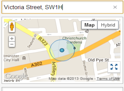
The first shows where you are if you try to plan a journey using your current location as the start point – click on the use my location option in the drop down for starting locations:
![]()

Note the full screen button in the bottom right of all the maps, allowing you to better explore:![]()

You can see the third map when you investigate an individual leg of the journey you have planned (by clicking on Show map). For the leg shown below you are able to take either the Circle or District line from the same platform, so both colours are shown on a single polyline, to make sure there are no gaps. Here I planned a trip from St. James’s Park to Bank. See this route for yourself here.


River routes have been mapped clearly, by suppressing Google’s in built river ferry routes. Here I planned a trip from London Bridge Pier to Greenwich Pier. See this route for yourself here.


Thanks to the recent introduction of Google Map Maker in the UK, should you see any corrections that are required on the underlying Google Maps, go ahead and make a suggestion!
https://google-latlong.blogspot.co.uk/2013/04/welcoming-united-kingdom-to-google-map.html
We’re really looking forward to hearing your thoughts on the new TfL Journey Planner maps. If you’ve got questions on these, or any other maps, please get in touch!
Earthware: +44 (0) 845 642 9880
https://www.earthware.co.uk/contact-earthware.aspx
Or email Giles Collingwood: giles@earthware.co.uk